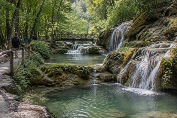
Emen Canyon: The Negovanka Eco Trail And Waterfall
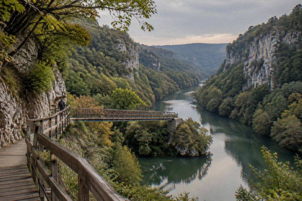
Emen Canyon is the gorge of the Negovanka river, about 20 km west of Veliko Tarnovo and 8 km off the Sofia road, with 90 m sheer cliffs at Lower Boaz. This guide covers where it sits, how the road distances work out, what the ERA5 climate normals say month by month, and how to fold it into a wider day in northern Bulgaria.
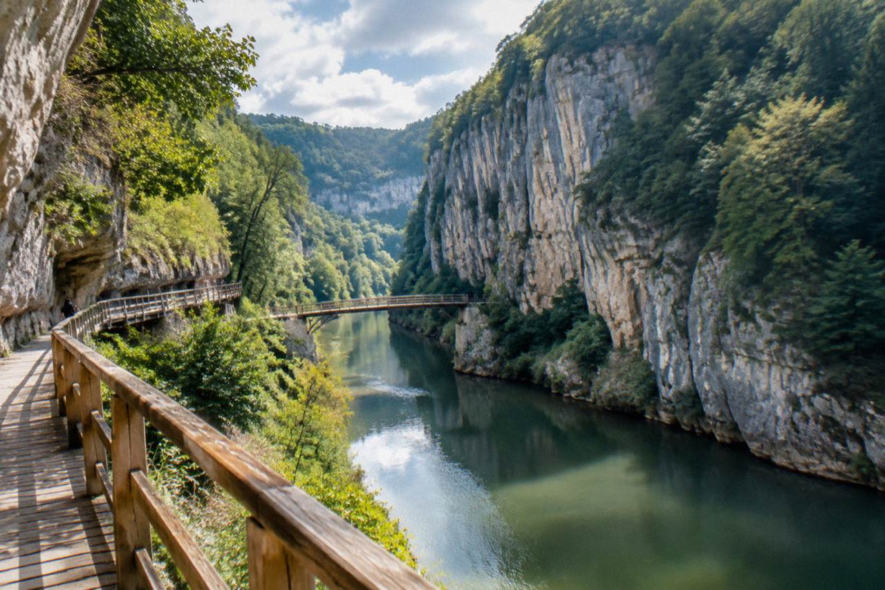
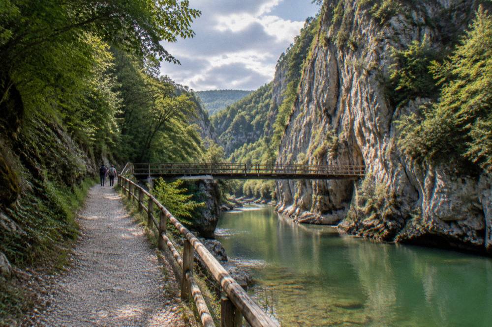
Emen Canyon lies about 20 km west of Veliko Tarnovo, an inland city on the Yantra river in Bulgaria, and about 32 km from the centre by road. It is the gorge of the Negovanka river, and Lower Boaz has 90 m sheer cliffs, per the municipal tourism site.
Emen Canyon is the gorge of the Negovanka river, about 20 km west of Veliko Tarnovo, the inland former medieval capital on the Yantra river in northern Bulgaria, and about 8 km off the road to Sofia. The figure that defines the place is at Lower Boaz, where the cliffs rise in sheer faces of 90 m, per the municipal tourism site. By road from the city centre the route runs about 32 km.
Where Is Emen Canyon Relative To Veliko Tarnovo?
Emen Canyon sits about 20 km west of Veliko Tarnovo and about 8 km off the Sofia road, reached by a route of about 32 km from the city centre, per the municipal tourism site and the road-distance data. The gorge is cut by the Negovanka river, and its best known section, Lower Boaz, has sheer cliffs of 90 m. The village of Emen gives the site its name and sits at the gorge itself.
That is the whole geography of the place in one paragraph, and the two distance figures are not in conflict. The municipal tourism site measures the canyon about 20 km west of the city as the crow flies, while the driving route from the centre comes out at about 32 km on the OSM-derived road network. Say one or the other depending on whether you are looking at a map or planning a drive, and never treat them as rival claims.
The wider setting matters too. Veliko Tarnovo is an inland city on the Yantra river, with no sea coast anywhere near it, and the municipality counted an estimated 77,067 residents on 31 December 2025. The city was the capital of the Second Bulgarian Kingdom for more than two centuries from the late 12th century, and the modern region around it is a belt of gorges, caves and river valleys: the Negovanka at Emen, the Rusenski Lom near Ivanovo, the Prohodna and Devetashka caves to the west, and the Krushuna falls near Lovech.
| Fact | Figure | Basis |
|---|---|---|
| Distance west of Veliko Tarnovo | about 20 km | municipal tourism site |
| Distance off the Sofia road | about 8 km | municipal tourism site |
| Road distance from the centre | about 32 km | computed on the OSM road network |
| River | the Negovanka | municipal tourism site |
| Sheer cliffs at Lower Boaz | 90 m | municipal tourism site |
| Nearest village | Emen | municipal tourism site |
What Kind Of Landscape Is The Negovanka Gorge At Emen?
The gorge belongs to the same karst belt that produces the caves and waterfalls of northern Bulgaria, including Devetashka Cave about 89 km away and Krushuna Falls about 79 km from the centre.
Karst is the organizing idea of this whole region. Water moves through limestone, and what it leaves behind is gorges, caves, springs and travertine waterfalls. Emen Canyon is the gorge expression of that process on the Negovanka; Devetashka, Prohodna and the Bacho Kiro cave near Dryanovo are the underground expression of it. The gorge and the caves are, geologically speaking, part of the same story told in different ways, which is why a canyon visit pairs so well with a cave visit on the same loop west or north.
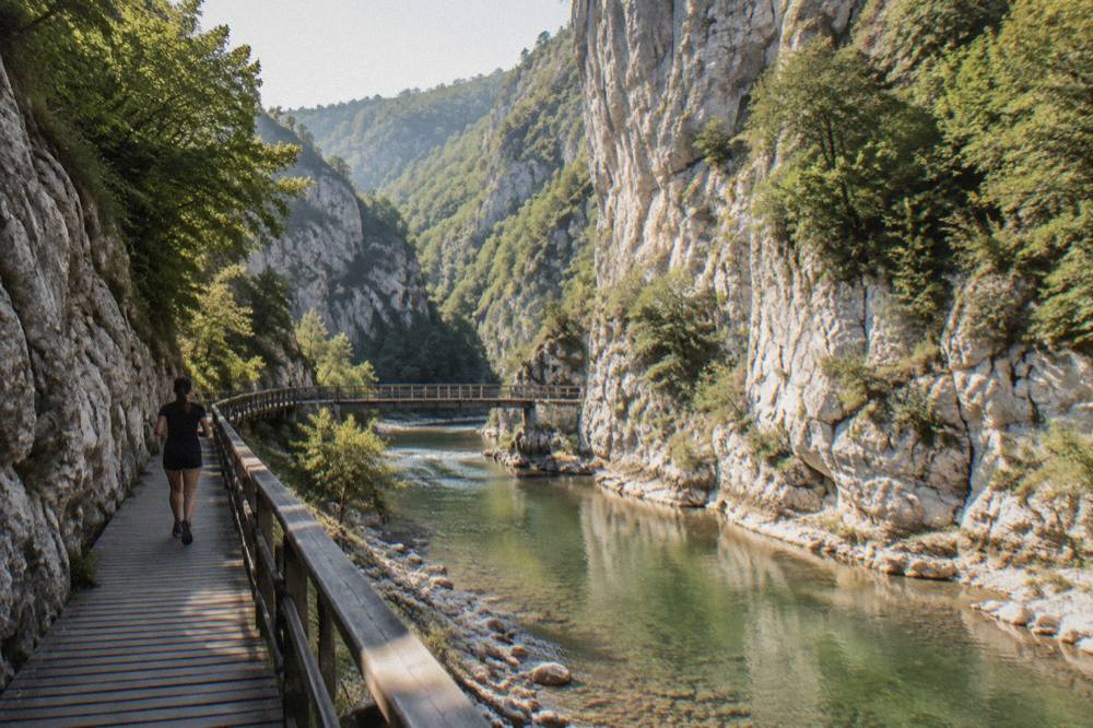
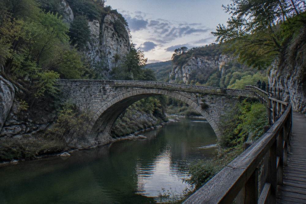
The cliff figure deserves its own sentence, because it is the one number the municipal tourism site attaches to the site: at Lower Boaz the walls stand 90 m sheer. That is a vertical measurement, not a slope, and it is what gives the gorge its enclosed, shadowed character in the middle hours of the day. Everything else about the trail itself, its length, its markers and its current condition, is the kind of detail that changes with maintenance seasons, so check locally at the Veliko Tarnovo Tourist Information Centre before setting out.
How Do You Get To Emen Canyon From Veliko Tarnovo?
From central Veliko Tarnovo the driving route to Emen Canyon is about 32 km, turning off the Sofia road about 8 km before the village, with the gorge lying about 20 km west of the city. Public transport detail for the final leg is thin, so a rental car, a taxi arranged in the city or a guided day tour is the practical planning basis.
If driving the route out from the city yourself appeals, book a rental car.
The road geometry is simple. You leave Veliko Tarnovo heading west on the Sofia road, and about 8 km off that road sits Emen and its gorge. The full route from the centre computes to about 32 km on the road network, which is a comfortable half-day outing or a shorter stop on a longer loop. For orientation, the distances from the centre to the other anchors of the region run like this.
| Nature site | Road distance from the centre |
|---|---|
| Emen Canyon | about 32 km |
| Bacho Kiro cave | about 31 km |
| Dryanovo Monastery | about 33 km |
| Krushuna Falls | about 79 km |
| Shipka church | about 79 km |
| Devetashka Cave | about 89 km |
| Kazanlak tomb | about 98 km |
| Ivanovo rock churches | over 100 km |
Note what that table does for planning. Emen Canyon, Bacho Kiro cave and Dryanovo Monastery sit in a tight band between about 31 and 33 km, which makes a single combined loop east of the canyon entirely natural: gorge in the morning, monastery and cave after. The western cluster, Krushuna and Devetashka, is a different day, and the Dryanovo Monastery and Bacho Kiro cave guide covers that eastern pairing in detail.
If you would rather not drive, guided products fill the gap. The options below cover both the canyon country and the city itself, with prices and ratings rendered live from the operators' listings.
The eco tour in that band is the closest fit for a canyon-centred day, since it is built around the outdoors of the Veliko Tarnovo area rather than museum interiors. Whatever you book, read the pickup point and the covered route on the operator's page before committing, because itineraries in this region get adjusted for weather and track conditions.
One more practical anchor: the region's rail and bus hub for long-distance arrivals is Veliko Tarnovo itself, with the Gorna Oryahovitsa junction about 10 km from the centre for train changes. Sofia airport lies about 216 road km away, Varna about 214 and Bucharest Otopeni about 205, so Emen Canyon is a stop on a Bulgaria itinerary, not a first destination from the airport.
When Is The Best Time Of Year To Visit Emen Canyon Near Veliko Tarnovo?
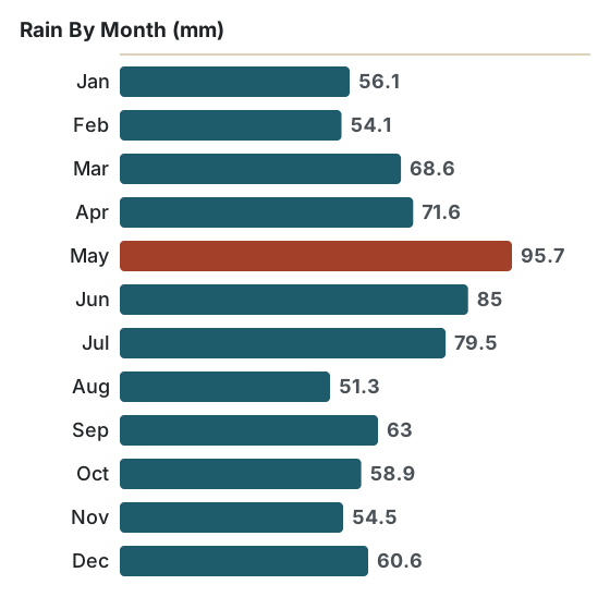
The ERA5 reanalysis for Veliko Tarnovo, 1991 to 2020, puts the mean daily high at 27.6 C in July and 28.1 C in August, against 4.9 C in January, with rain peaking at 95.7 mm in May and falling to 51.3 mm in August. A gorge walk is a hot-weather activity in this climate, and the shoulder months of September, at a 23.3 C mean high with 63.0 mm of rain, offer a middle course.
Gorges are shade machines, which is exactly why they suit the Bulgarian summer. The 90 m walls of Lower Boaz hold cool air and shadow through the middle of the day, and a river walk in July compares well with an exposed hillside walk in the same weather. The trade-off is water: May carries the heaviest rain of the year in the modelled normals, at 95.7 mm, and June follows at 85.0 mm, so late spring combines green surroundings with wet ground.
| Month | Mean daily high C | Mean daily low C | Rain mm |
|---|---|---|---|
| Jan | 4.9 | -3.8 | 56.1 |
| Feb | 7.2 | -2.3 | 54.1 |
| Mar | 11.5 | 1.4 | 68.6 |
| Apr | 16.9 | 6.0 | 71.6 |
| May | 21.7 | 11.1 | 95.7 |
| Jun | 25.4 | 15.1 | 85.0 |
| Jul | 27.6 | 17.2 | 79.5 |
| Aug | 28.1 | 17.1 | 51.3 |
| Sep | 23.3 | 12.9 | 63.0 |
| Oct | 17.6 | 8.0 | 58.9 |
| Nov | 11.8 | 3.1 | 54.5 |
| Dec | 6.1 | -1.7 | 60.6 |
These are modelled grid-cell values, not a weather station record, and they describe the climate of the Veliko Tarnovo area rather than a forecast for your date. The pattern they show is continental: a real winter with a January mean low of -3.8 C, a warm summer, and rain spread across every month with a spring maximum. For a fuller month-by-month treatment, see the best time to visit Veliko Tarnovo data and the climate discussion on the main guide to things to do in Veliko Tarnovo.
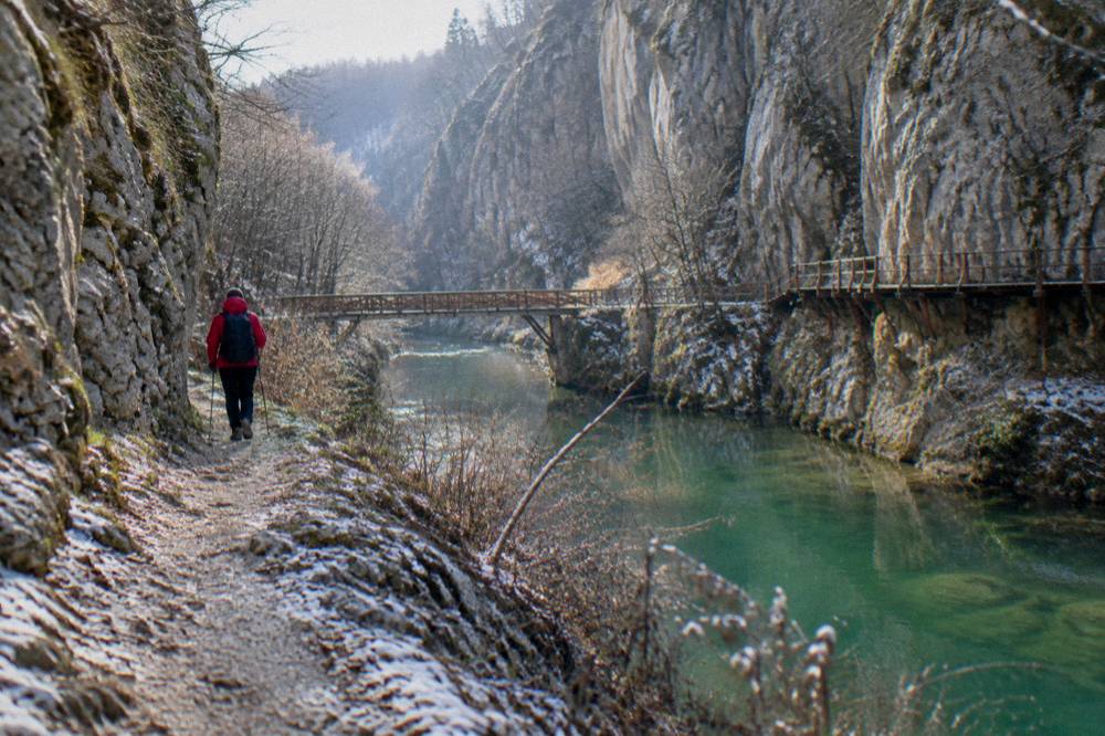
Winter deserves a caveat for this specific site. Ice and wet limestone change the character of any gorge trail, and the January mean low of -3.8 C says freeze-thaw conditions are normal. The museum sites of the region also shift to winter hours from 25 October 2026, which matters if your canyon day doubles as a museum day: Trapezitsa closes to visitors from 30 November 2026 to 31 March 2027, and the Trapezitsa funicular stops for the season on 31 October 2026. The gorge itself is a natural site with no such schedule, but plan the rest of the day around those dates if you are travelling late in the year.
What Should You Budget For A Day Around Emen Canyon?
Emen Canyon is an open gorge on the Negovanka river rather than a ticketed museum site, so the printed figures for a day in the area come from the sights around it: Nicopolis ad Istrum at 5.11 euro per adult, Etar at 7.16 euro per adult, and Tsarevets Fortress in the city at 7.67 euro with a family ticket at 10.23 euro, all per the operators' ticket pages. Transport and any guided product sit on top of that.
The useful framing is to budget the loop, not the canyon. A day that runs Emen in the morning and Nicopolis ad Istrum in the afternoon carries one printed entry figure, 5.11 euro at the Roman ruins per the Regional Museum of History's listing, and the ruins lie about 20 km from the centre, on the same side of the region as a northern extension. A day that swaps in Etar, the open-air museum near Gabrovo at about 53 km, carries Etar's own tariff scale, printed on the official admission page. The full index of guides sits on Veliko Tarnovo Travel Guide.
| Ticketed site near the loop | Adult | Source page |
|---|---|---|
| Nicopolis ad Istrum | 5.11 euro | the museum's ticket page |
| Etar Architectural-Ethnographic Complex | 7.16 euro | the official admission page |
| Tsarevets Fortress (in the city) | 7.67 euro | the museum's ticket page |
| Trapezitsa (in the city) | 5.11 euro | the museum's ticket page |
Two cautions go with that table. First, the museum network prices its sites in euro since Bulgaria adopted the currency on 1 January 2026 at a fixed rate of 1.95583 lev per euro, so the figures above are the printed euro prices, not conversions to be recalculated. Second, the two-day pass covering ten museum sites, at 20.45 euro for an individual, is valid 1 April to 30 November, which is exactly the season a canyon trip wants anyway.
Guided products render their own prices and ratings from the operators' listings, so treat the tile below as the live source of the figure rather than anything typed in prose.
That waterfalls-and-caves product is one way to buy the region's karst highlights in a single day without driving yourself; the monasteries variant below leans toward the ecclesiastical side of the same countryside.
Which Day Trips Combine Well With Emen Canyon From Veliko Tarnovo?
The natural pairings for Emen Canyon are the eastern cluster of Dryanovo Monastery and Bacho Kiro cave at about 33 and 31 km respectively, the Etar open-air museum at about 53 km via Gabrovo, and, on the city side, the Preobrazhenski Monastery at 6 km or the Holy Trinity Monastery at 7 km as short add-ons before or after the drive. Krushuna Falls and Devetashka Cave, at 79 and 89 km, make a separate western day.
Think of the region as three loops. The near loop is monastic: Preobrazhenski, Holy Trinity and Kilifarevo monasteries at 6, 7 and 17 km, close enough to bolt onto any morning. The eastern loop is the canyon-and-cave day, with Emen, Bacho Kiro and Dryanovo Monastery all inside a band of about 31 to 33 km from the centre. The far loop is the west and south: Krushuna, Devetashka, Lovech at 86 km, Shipka and Buzludzha at 79 and 73 km, and Kazanlak at 98 km.
| Monastery or near-city point | Road distance from the centre |
|---|---|
| Preobrazhenski Monastery | about 6 km |
| Holy Trinity (Patriarchal) Monastery | about 7 km |
| Gorna Oryahovitsa station | about 10 km |
| Kilifarevo Monastery | about 17 km |
| Nicopolis ad Istrum | about 20 km |
The Kilifarevo row carries a seasonal note: the history museum in Kilifarevo opens by prior request on working days and is closed 30 November 2026 to 30 March 2027, so a winter loop that counts on it will be disappointed. The monastery itself is a separate matter from the museum, as covered in the Kilifarevo monastery guide.
For the cave-and-waterfall day, the dedicated pages on Krushuna Falls, Devetashka Cave and Prohodna Cave carry the itineraries, and the Etar architectural complex guide covers the open-air museum that anchors the Gabrovo side of the eastern loop. Buzludzha, at about 73 km, is a longer detour whose interior is reported as generally closed, so treat it as an exterior stop and confirm locally.
An active alternative exists for travellers who want the canyon country with an engine. An ATV and quad off-road tour runs in Veliko Tarnovo and Arbanasi, covering open terrain rather than museum halls, and it can sit alongside a self-driven canyon day as a contrast. Details and the live price are on the operator's listing: Check availability.
What Should You Pack For The Emen Canyon Trail?
Pack for a continental-climate river walk: the ERA5 reanalysis for Veliko Tarnovo, 1991 to 2020, puts July mean highs at 27.6 C and January mean lows at -3.8 C, with rain in every month of the year, so sun protection and water matter from May to September and grip and layers matter from November to March. Sturdy footwear with real tread is the constant, because gorge paths run over rock and river cobbles.
The month-by-month table above is the packing list in disguise. April to September spans mean highs of 16.9 to 28.1 C, which is walking weather with a sun problem: a hat, water and a start earlier in the day solve it, and the gorge shade does the rest once you are between the walls. October to March spans mean highs of 4.9 to 17.6 C with mean lows below freezing in December through February, which points to layers, a shell for the November and December rain of 54.5 and 60.6 mm, and footwear that holds a wet rock.
Two situational items complete the kit. The emergency number in Bulgaria is 112, EU-wide and free, and it works from any phone in the gorge area. And since Bulgaria has been a full Schengen member since 1 January 2025 and uses the euro since 1 January 2026, there is no currency arithmetic left to do: whatever euro you carry in the city works at the village shop, the petrol station and every ticket desk in the region.
How Does Emen Canyon Compare With The Other Nature Day Trips Near Veliko Tarnovo?
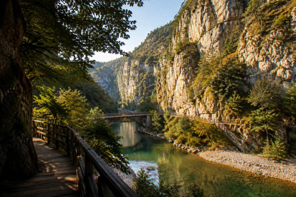
Emen Canyon is the gorge option at about 32 km by road, while Krushuna Falls at 79 km, Devetashka Cave at 89 km and Prohodna Cave offer the water and underground versions of the same karst landscape, and Dryanovo Monastery with Bacho Kiro cave at 33 and 31 km offers the closest combined nature-and-history pairing. The canyon is the shortest drive of the pure nature sites and the only one defined by vertical rock rather than water or caverns.
The comparison is really about what kind of day you want. A gorge is a linear walk between walls, with the Negovanka as the companion; a cave is an interior; a waterfall is a destination with a swim stop in summer. Distance then does the sorting: Emen is the nearest of the pure nature sites, the Dryanovo pairing is the nearest mixed day, and everything else sits at 79 km or more from the centre, which turns it into a full-day loop with a real drive on either end.
| Nature day trip | Type | Road distance from the centre | Nearest companion |
|---|---|---|---|
| Emen Canyon | river gorge | about 32 km | Dryanovo Monastery |
| Bacho Kiro cave | show cave | about 31 km | Dryanovo Monastery |
| Dryanovo Monastery | monastery and cave area | about 33 km | Bacho Kiro cave |
| Krushuna Falls | travertine falls | about 79 km | Devetashka Cave |
| Devetashka Cave | large cave | about 89 km | Krushuna Falls |
| Ivanovo rock churches | river valley churches | over 100 km | Ruse at 105 km |
The Ivanovo row is the outlier that earns its "over 100 km": the underlying figure of 128 km measures to a protected-area centroid and overstates the drive to the site itself, so the honest printed form is "over 100 km". Ivanovo is also one of the two inscribed UNESCO World Heritage Sites in the wider region, from 1979, alongside the Thracian Tomb of Kazanlak, also 1979; nothing in Veliko Tarnovo itself, including Tsarevets and the Old Town, is inscribed or on the Tentative List, and Nicopolis ad Istrum, about 20 km away, has been on the Tentative List since 1984.
A final thought on ordering the region. The canyon, the caves and the monasteries are all inside a two-hour driving radius of the city, and the city itself, with Tsarevets open 08:00 to 20:00 from April to September and the Sound and Light show running on announced evenings, free to watch from Tsar Asen I Square, makes a strong evening bookend to any of these days. The Lovech guide and the Tryavna guide cover the two other towns that anchor the outer loops.
Common Questions About Emen Canyon
How far is Emen Canyon from Veliko Tarnovo?
Emen Canyon lies about 20 km west of Veliko Tarnovo and about 8 km off the Sofia road, per the municipal tourism site. The driving route from the city centre computes to about 32 km.
What is the Negovanka river?
The Negovanka is the river that cut Emen Canyon, and the gorge is its defining feature.
Do you need a ticket for Emen Canyon?
Emen Canyon is an open natural gorge on the Negovanka, not a museum site with a ticket page. The printed figures in the area belong to the ticketed sights around it, such as Nicopolis ad Istrum at 5.11 euro and Etar at 7.16 euro per adult.
What is the best month to visit Emen Canyon?
The ERA5 reanalysis for Veliko Tarnovo, 1991 to 2020, shows mean daily highs of 27.6 C in July and 28.1 C in August with rain down to 51.3 mm in August, while May carries the year's heaviest rain at 95.7 mm. A gorge walk suits the warm months for shade, and September, at a 23.3 C mean high, is a temperate middle course.
Can you combine Emen Canyon with other day trips?
Yes. Dryanovo Monastery and Bacho Kiro cave sit at about 33 and 31 km, the same band as the canyon, and Etar lies about 53 km via Gabrovo. Krushuna Falls and Devetashka Cave, at 79 and 89 km, work better as their own western day.
Is Emen Canyon near a UNESCO site?
Nothing in Veliko Tarnovo, Emen Canyon included, is a UNESCO World Heritage Site or on the Tentative List. The nearest inscribed sites are the Rock-Hewn Churches of Ivanovo and the Thracian Tomb of Kazanlak, both from 1979, and Nicopolis ad Istrum, about 20 km from the centre, has been on the Tentative List since 1984.
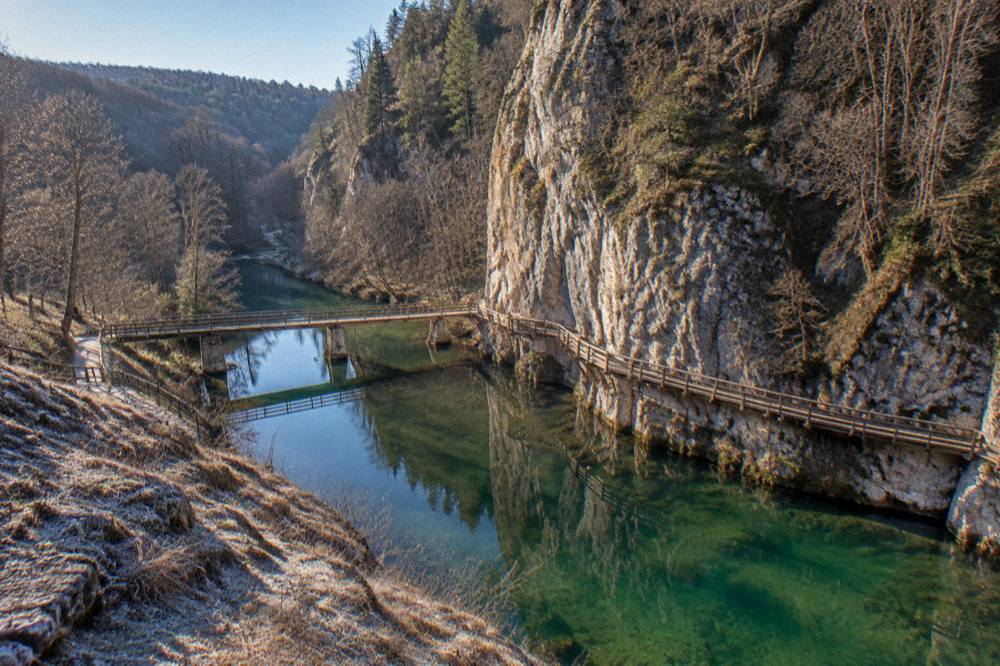
Emen Canyon rewards exactly the kind of day this region does best: a short drive out of Veliko Tarnovo, an hour or two between 90 m walls with the Negovanka for company, and a monastery, a cave or a museum site folded in on the way back, with the city's fortress and its announced-evening light show waiting after dark. Pick the loop that matches your season, check the trail conditions and the museum winter dates before you go, and the gorge will do the rest.